035 Tour to the "Mausloch Alm" hut
Quick Overview
| Distance | 24.1 km |
|---|---|
| Elevation gain | 1.250 m |
| Elevation gain | 1.250 m |
| Duration | 3:00 h |
|
Condition
1 = very easy (max. 200 hm) |
|
|
Driving technique (S0 - S5)
The rating of the driving technique is based on the values of singletrail-skala.de.
S0 = S0 describes a single trail that has no special difficulties. These are mostly liquid forest and meadow paths on grippy natural soils or gravel solidified. Stages, rock or root sections are not expected. The slope of the path is light to moderate, the curves are extensive. |
|
Tour months
Equipment
Course: Naturno – farm „Plon“ – car park Kreuzbrünnl along the Bike Highline to the Ötzi trail – Platzgumm – Naturno
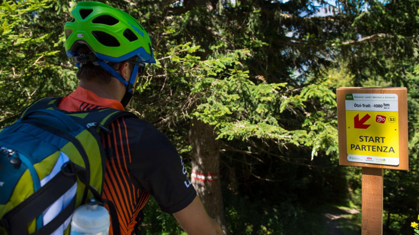
With this tour we check out the immediate surroundings of Naturno. From the tourist office of Naturno we ride to the main street, then continue to the right until we get to the first crossroad, where we turn left into Via Stazione. We come to a bridge where we cross the Adige river, to reach the sports field, the starting point of the climb to the Monte Tramontana di Naturno. This road leads all the way up to the parking area "Kreuzbrünnl" (1600m). Those who don't want to complete the whole uphill, have the possibility to access the rewarding downhill trail half way. Opting for this, after 7,6 km and 710 meters of elevation gain, follow the signs to the farm "Platzgumm". Just before the farm the access to the lower part of the "Ötzi trail" can be found. Those who complete the entire uphill to the parking area "Kreuzbrünnl", can now take the Merano Bike-Highline to the "Mauslochalm", where we find the starting point of the technically demanding "Ötzi trail" just below the hut. The S3 trail offers everything a mountainbiker's heart desires. From flowy sections in the upper part, to really rocky and blocked, but always passable sections in the lower part, the trail is the perfect mixture of pleasure and challenge. Following the road past the restaurant "Waldschenke" we get to Cirlano and back to Naturno. This tour can be shorten significally by taking the available bike shuttle to the parking area "Kreuzbrünnl".
Back to the overview


