038 Merano Bike Highline Marathon
Quick Overview
| Distance | 57.9 km |
|---|---|
| Elevation gain | 1.900 m |
| Elevation gain | 1.900 m |
| Duration | 6:00 h |
|
Condition
1 = very easy (max. 200 hm) |
|
|
Driving technique (S0 - S5)
The rating of the driving technique is based on the values of singletrail-skala.de.
S0 = S0 describes a single trail that has no special difficulties. These are mostly liquid forest and meadow paths on grippy natural soils or gravel solidified. Stages, rock or root sections are not expected. The slope of the path is light to moderate, the curves are extensive. |
|
Tour months
Equipment
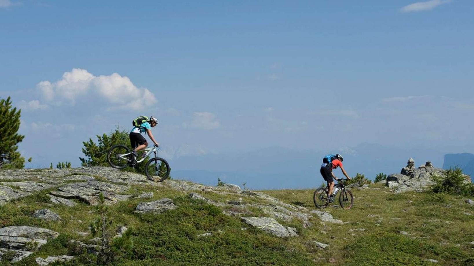
Course: Naturno - Castelbello – Uphill "Marzoner Alm" – Bike Highline Meran – Monte San Vigilio – restaurant "Seespitz" - "Stoanbruch" Trail - Tel – Naturno
From the town center of Naturno, we take Via Stazione which leads us to a bridge, the starting point of the cycle path on the Lungoadige. We turn right and take the cycle path towards Stava, Ciardes and finally Castelbello, where we turn left and follow the signs "Uphill Marzoneralm". The "Malga di Marzon" hut (1600m) is our first stage of the tour, which we reach after passing some steep uphill sections and the mountain village "Montefranco" (1200m). From the "Malga di Marzon" we take the Bike Highline Merano which connects the huts at Monte Tramontana via Castelbello with Tel. We follow the Bike- Highline mostly on forest roads in a constant up and down, to reach San Vigilio, where we ride past the church of San Vigilio to get to the restaurant "Seespitz". Just behind the restaurant, we access the "Stoanbruchtrail" (signposted) that brings us back to the bottom of the valley. Once we have reached the village Tel, we cross the bridge, turn left onto the cycle path and ride back to Naturno.
Back to the overview


