027 Tour to the "Marzoner Alm" hut (expert)
Quick Overview
| Distance | 34 km |
|---|---|
| Elevation gain | 1.100 m |
| Elevation gain | 1.100 m |
| Duration | 4:00 h |
|
Condition
1 = very easy (max. 200 hm) |
|
|
Driving technique (S0 - S5)
The rating of the driving technique is based on the values of singletrail-skala.de.
S0 = S0 describes a single trail that has no special difficulties. These are mostly liquid forest and meadow paths on grippy natural soils or gravel solidified. Stages, rock or root sections are not expected. The slope of the path is light to moderate, the curves are extensive. |
|
Tour months
Equipment
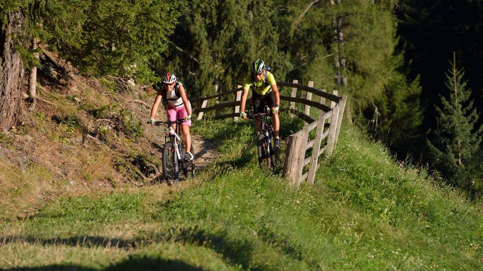
Course: Naturno – Stava – Ciardes – Castelbello - Malga Marzoner – Montefontana - Lupo Trail – Fontana Trail – Tablá – Naturno
From the town center of Naturno, we take Via Stazione / Bahnhofstraße which leads us to a bridge, the starting point of the cycle path on the Lungoadige / Etschdamm. We turn right and take the cycle path towards Stava, Ciardes and finally Castelbello, where we turn left and follow the signs towards "Uphill Marzoneralm". The hut "Malga di Marzon" (1600m) is the highest point of our tour. We reach this point after a few steep uphill sections, leading through the mountain village of "Montefranco" (1200m) and a total of 1000 meters of elevation gain. From the "Malga di Marzon", we take the Bike Highline Merano and follow the trails to reach the start of the "Lupotrail" (No. 4, signposted). On the "Lupotrail" we cross the forest road two times before getting to an asphalt street. There, we leave the trail to proceed on the asphalt street until the next hairpin bend, where we take trail no.9 (Fontanatrail), which brings us to the "Niedermair" farm. By following the technically demanding "Fontanatrail", with a lot of rocky and blocked but also flowy sections, we reach the bottom of the valley at Ciardes, where we take the cycle path to return to Naturno.
Back to the overview


