021 "San Martino" and the "Monte Sole Trail"
Quick Overview
| Distance | 40.6 km |
|---|---|
| Elevation gain | 1.300 m |
| Elevation gain | 1.300 m |
| Duration | 3:23 h |
|
Condition
1 = very easy (max. 200 hm) |
|
|
Driving technique (S0 - S5)
The rating of the driving technique is based on the values of singletrail-skala.de.
S0 = S0 describes a single trail that has no special difficulties. These are mostly liquid forest and meadow paths on grippy natural soils or gravel solidified. Stages, rock or root sections are not expected. The slope of the path is light to moderate, the curves are extensive. |
|
Tour months
Equipment
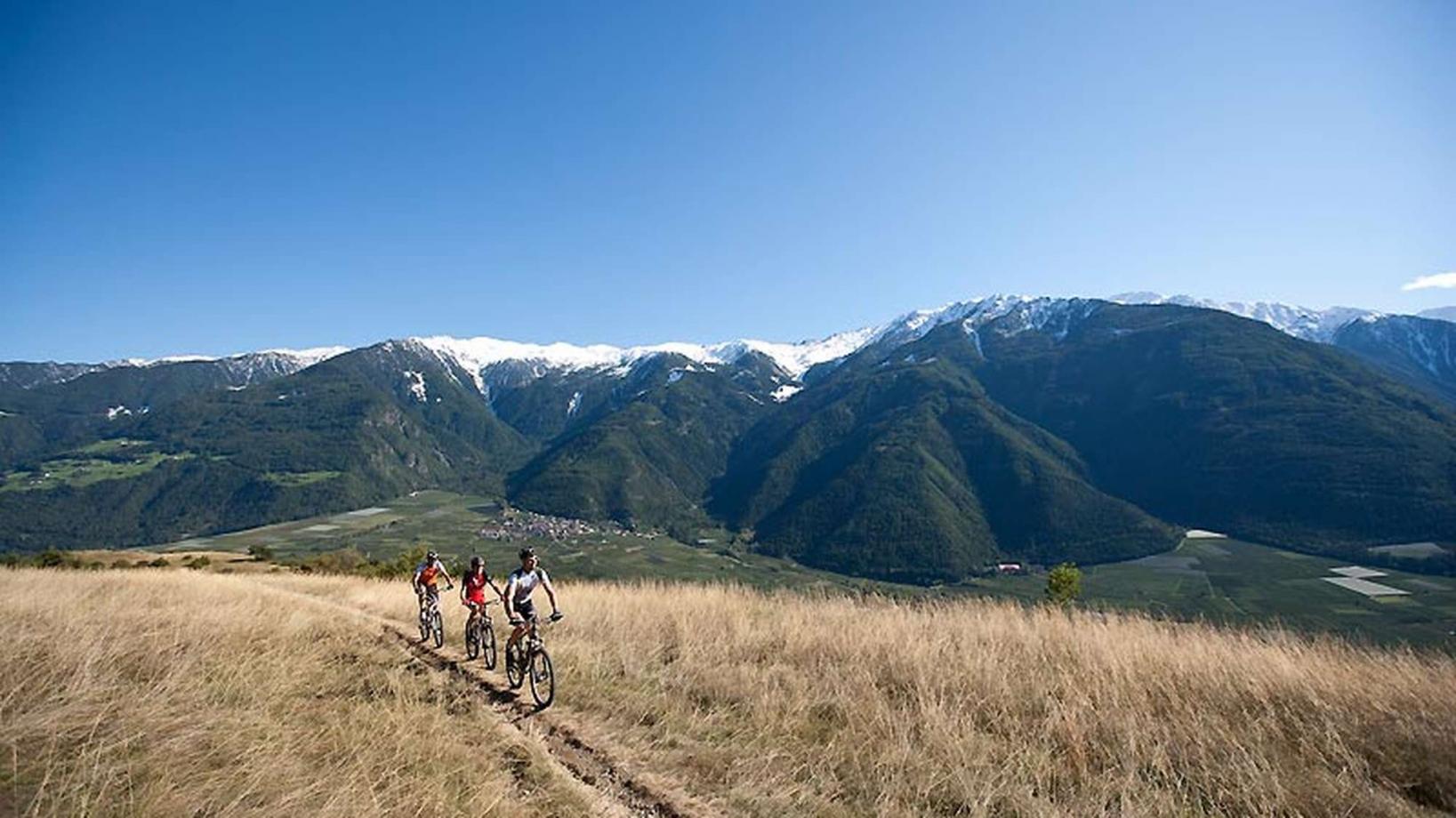
Course: Naturno (554 m) – Castelbello(600 m) – S. Martino al Monte (1.740 m) – "Monte Sole Trail" -Plateau “Annabergböden” (1.060 m) – Coldrano (700 m) – Laces (639 m) – Naturno
From the town center of Naturno, we take Via Stazione which leads us to a bridge, the starting point of the cycle path on the Lungoadige. We turn right and follow the cycle path towards Stava, Ciardes and finally Castelbello, where we cross the main street and start the climb to "Montetrumes" and "San Martino al Monte" (signposted). After this fairly steep and long climb we reach one of the highest permanently inhabitated villages in Italy, San Martino al Monte, offering breathtaking views over the mountains of the Vinschgau Valley. Heading downhill we follow the signed "Montesole trail". This technically demanding trail leads to the plateau of "Annaberg", where we enjoy the magnificent view down into the valley as far as Meran. The trail ends in Coldrano-Tiss, where we turn onto the cycle path to get back to Naturno.
Back to the overview


