020 San Martino al Monte- Easy Trail
Quick Overview
| Distance | 48 km |
|---|---|
| Elevation gain | 1.300 m |
| Elevation gain | 1.300 m |
| Duration | 4:00 h |
|
Condition
1 = very easy (max. 200 hm) |
|
|
Driving technique (S0 - S5)
The rating of the driving technique is based on the values of singletrail-skala.de.
S0 = S0 describes a single trail that has no special difficulties. These are mostly liquid forest and meadow paths on grippy natural soils or gravel solidified. Stages, rock or root sections are not expected. The slope of the path is light to moderate, the curves are extensive. |
|
Tour months
Equipment
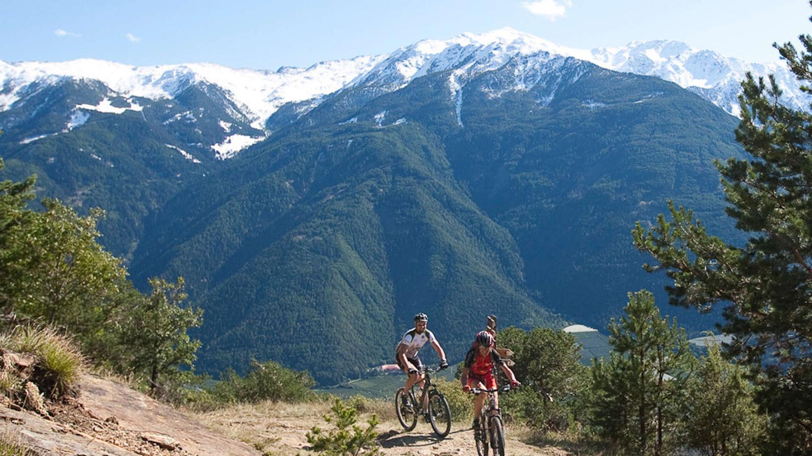
Course: Naturno – Castelbello – S. Martino in Monte – “Easy Trail” – Castle S. Anna – Vezzano – Coldrano – Laces – Naturno
From the town center of Naturno, we take Via Stazione / Bahnhofstraße which leads us to a bridge, the starting point of the cycle path on the Lungoadige / Etschdamm. We turn right and take the cycle path towards Stava and Ciardes to reach Castelbello, where we cross the main street and start the climb to "Montetrumes" and "San Martino al Monte" (signposted). After a mid-steep but long climb, we reach one of the highest permanently inhabited villages in Italy, San Martino al Monte. From there, we have a breathtaking view over the surrounding mountains. We start our downhill and ride some meters on the aspahlt street to reach our first trail on the right side ("Easy trail" S1). The "Easy Trail" flows along some broad, gravel trails, which is a lot of fun for beginners and experts alike. By following this trail, we also reach the Castle "Annaberg", where we can enjoy a really nice view over the Val Venosta. We proceed on the trail and get to Coldrano, where we take the country road to Tiss. We follow the "Tisserweg" through the orchards back to Laces, from where we take the cycle path back to Naturno.
Back to the overview


